The Story ofMichinoku Gold

story 1
—It All Began with a Hint of Gold—
Scroll

—It All Began with a Hint of Gold—
It was in Mutsu Province during the Nara period (710–794 CE) that gold was produced in Japan for the first time. Traditionally referred to as “Michinoku,” meaning “The Deep North,” this region includes present day Iwate and Miyagi Prefectures. The region is unique within Japan in that it possesses veins of gold first formed about 100 million to 450 million years ago. It had been common knowledge that there was no gold to be found in Japan, until the discovery of a single flake of gold here in Michinoku overturned that idea and created a sudden appetite for the precious metal.
Gold mining in Michinoku began with the collection of gold dust, with operations eventually spreading to rivers and coasts throughout the region, turning the area into one of the leading gold producers in Asia. Once the technology to extract gold from ore was introduced, the feudal rulers of the time actively pursued the development of gold mines. As technology evolved to enable industrial-scale mines, the production of gold in Michinoku reached its peak. By the late twentieth century, gold mines in the region had largely ceased operation. This brought the remarkable story of Michinoku Gold to an end, the conclusion of over 1,250 years of history rooted in an even longer geological heritage.

Cultural Properties
-

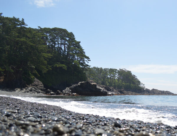
Cape IwaisakiSanriku Fukko National Park
Designation statusundesignated (Natural Monument)
One of the capes located along the Sanriku ria coastline, Cape Iwaisaki is also part of the Sanriku Geopark. In addition to the the scenic beauty of seawater shot high into the air when waves strike cracks in the eroded rock, it also features exposed Paleozoic geology, rare in the Japanese archipelago. This is a precious location where you can find geological “borders” that indicate the presence of gold veins.
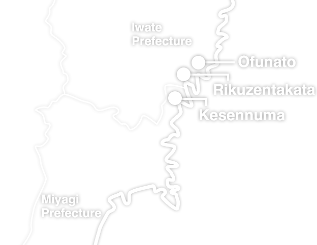
LocationKesennuma
-
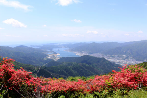
Mt. Hikami
Designation statusundesignated (Place of Scenic Beauty, Natural Monument)
This 874-meter-high mountain is part of the Sanriku Geopark. It is is made of Hikami granite from 450 million years ago. Known for over 1,000 years as a valuable source of high-quality gold and crystals, the ruins of Tamayama Gold Mine are located here on the slopes of Mount Hikami.
LocationRikuzentakata
-
Illustrated map of Kesen and Motoyoshi
Designation statusCity Tangible Cultural Asset (Historical Materials)
An early-modern era illustrated map that marks in gold the thirty-four gold mines in Kesen (the area encompassing Ofunato, Rikuzentakata, and Sumita in Iwate Prefecture) and Motoyoshi (the area encompassing Kesennuma and Minamisanriku in Miyagi Prefecture) Districts. Looking at it, one can see that the sources of gold were scattered over a wide area. It is a valuable document that concretely shows the situation in which Sengoku-era warlords such as Toyotomi Hideyoshi and Date Masamune took control of the areas resources and actively developed gold extraction operations.
LocationKesennuma
-
Mt. Imade
Designation statusUnspecified (Scenic Spot / Natural Monument)
Approximately 110 to 130 million years ago, during the Early Cretaceous, active undersea volcanoes pushed up igneous rocks like andesite from deep underground, forming the foundation of Mt. Imade. Gold-bearing hydrothermal fluids from magma seeped into the resulting crevices, cooling to form gold veins. The Imadeyama Gold Mine within the mountain tells the story of these ancient geological transformations and the history of gold formation.
LocationOfunato
-
Goishi Coast
Designation statusNational Scenic Spot & Natural Monument / National Park
The Goishi Coast features striped strata formed by submarine deposits of mud and sand. Here, traces of intense orogenic activity (mountain-building) from early Cretaceous undersea volcanic eruptions are visible everywhere. The folds of Anatoshi-iso, the black shale of Goishihama, and the hornfels of Tarumihama stand as testaments to the massive geological shifts that birthed the gold of Michinoku, offering a profound sense of eternal time.
LocationOfunato